
NGEE Arctic team members attended the 10th Annual ABoVE Science Team Meeting to indroduce Phase 4 of the project to facilitate ongoing and new collaborations between NGEE Arctic and NASA ABoVE.
NASA’s Arctic-Boreal Vulnerability Experiment (ABoVE) held its 10th Annual Science Meeting in Boulder, Colorado from 21–25 May 2024. The ABoVE project is a decadal airborne campaign, focusing on filling observation and knowledge gaps in arctic and boreal ecosystems through intensive collection of advanced remote sensing data. The ABoVE campaign has been a close and collaborative partner of the NGEE Arctic project throughout NGEE Arctic Phases 1-3. The ABoVE meeting gathered ~160 project scientists, students, and collaborators to discuss research progress and future activities. Several NGEE Arctic team members attended the meeting, where they introduced proposed plans for Phase 4 and participated in ABoVE discussions exploring roadmaps for various potential collaboration activities, through syntheses (Table a), model benchmark and validation, and assimilation of ABoVE remote sensing data into the Department of Energy’s International Land Model Benchmarking (ILAMB) package. These activities aim to facilitate exchange of data and knowledge between NGEE Arctic and ABoVE to enable pan-Arctic scale understanding and model development. We also identified key ABoVE products that could be useful for NGEE Arctic Phase 4 modeling efforts (Table b).
Contact and email address: Daryl Yang (yangd@ornl.gov); Daryl is the NGEE Arctic liaison to the NASA ABoVE project.
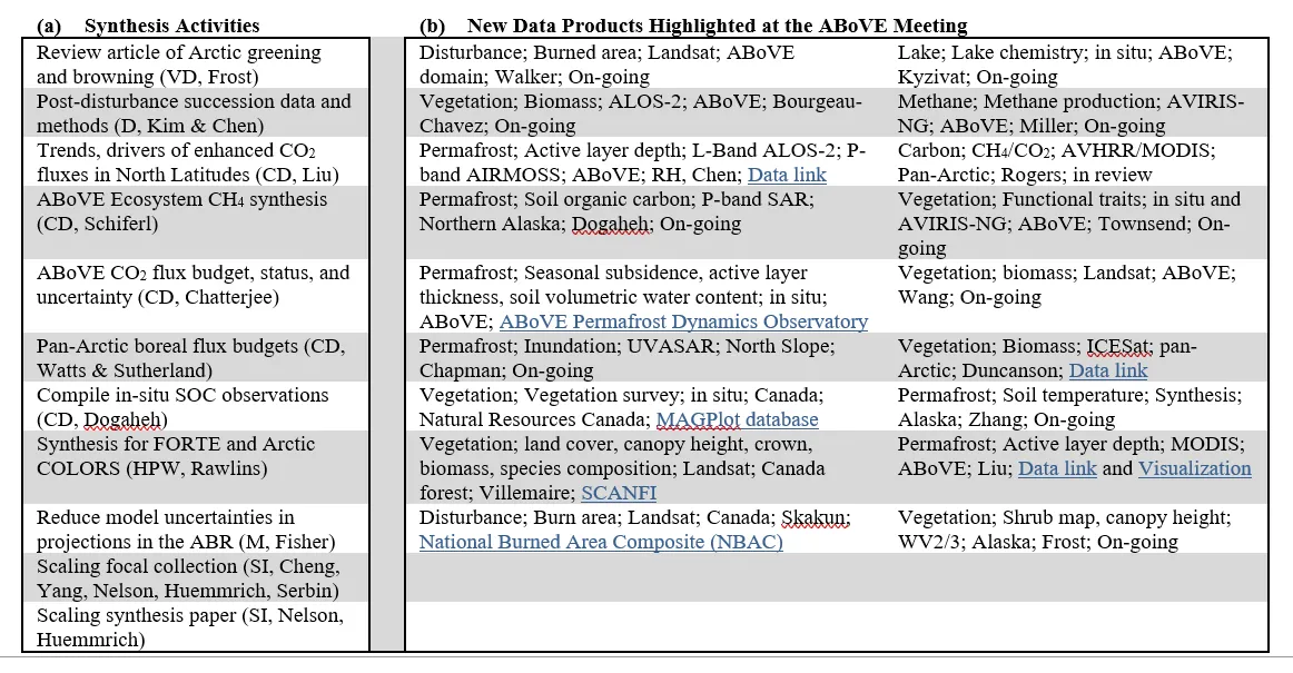
(a) Synthesis activities and (b) data products of interest to the NGEE Arctic team featured during the 10th Annual ABoVE science team meeting. (a) Working groups: VG is Vegetation Dynamics; D is disturbance; CD is Carbon Dynamics; HPW is Hydrology, Permafrost, and Wetlands; M is modeling; SI is spectral imaging. The name following each working group designation in synthesis activities is the contact for each synthesis activity. (b) Data products of interest include information on data product type, spatial or synthetic information of interest, sensor used, scale of focus, source of data, contact, and data link where available.