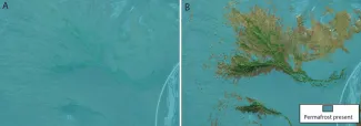
High-resolution maps of near-surface permafrost for three watersheds on the Seward Peninsula, Alaska derived from machine learning.
Permafrost, ground which is frozen for at least two consecutive years, is a key characteristic of arctic landscapes. As the Arctic continues to warm at rates up to 4 times faster than the rest of the globe, permafrost is becoming increasingly vulnerable to thaw and degradation. Thawing of permafrost soils is predicted to lead to a dramatic flux of carbon from the terrestrial environment to the atmosphere and exacerbate climate warming. Additionally, degradation of ice-rich permafrost can result in significant land surface subsidence, which can damage critical infrastructure, such as pipelines, roads, airport runways, and buildings. Predictions of permafrost extent are thus vital for understanding the potential flux of carbon to the atmosphere and assessing the vulnerability of critical infrastructure to permafrost thaw. Pan-Arctic products of permafrost presence are generated at the scale of ~1 km2, which is too coarse to estimate potential carbon fluxes or infrastructure vulnerabilities. Furthermore, there is significant disagreement in predicted permafrost extent among pan-Arctic products. Using permafrost presence and absence data collected by NGEE Arctic, along with remote sensing data, machine learning models were trained to generate high-resolution predictions of permafrost presence across three watersheds on the Seward Peninsula, Alaska. The predictions generated from the machine learning models represent a drastic improvement in the spatial resolution of permafrost predictions using high-resolution topographic and satellite data. The models predicted permafrost presence with an accuracy ranging from 70%–90% and show significant promise of transferability to locations with similar topography and ecosystems.
Citation: Thaler EA, Uhleman S, Rowland JC, Schwenk J, Wang C, Dafflon B, Bennett KE. 2023. High-resolution maps of near-surface permafrost for three watersheds on the Seward Peninsula, Alaska derived from machine learning. Earth and Space Science 10: e2023EA003015. https://doi.org/10.1029/2023EA003015
For more information, please contact:
Evan Thaler


