
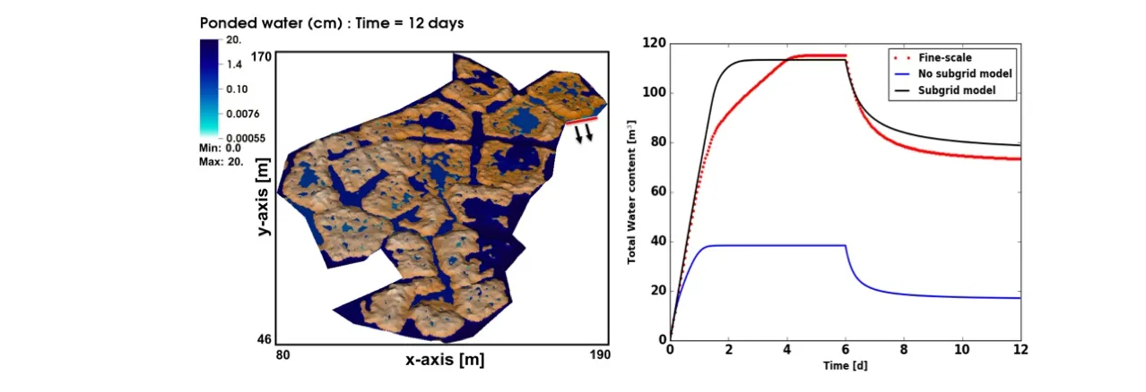
Microtopography, or topographic variation across scales much smaller than the domain of interest, plays a critical role in surface water retention, surface/subsurface interactions, and runoff. High resolution surface flow-only simulations are capable of capturing microtopographic features and are feasible with modern computing tools. However, such resolution for integrated surface/subsurface hydrology simulations across a watershed are not feasible, which motivates the development of subgrid models that simulate the domain at a coarser resolution but still capture some effects of the microtopography. Using polygonal tundra in the Arctic as an example, we present a subgrid model for surface flow that captures the effects of microtopography. The subgrid model alters the water storage and flow terms in the diffusion wave equation for surface flow. Our findings confirm that a properly parameterized subgrid model improves the representation of hydrographs and total water content in the system. We test several strategies for determining the depression depth, a key model parameter, from calibration, geometric arguments, and through a classification approach. The classification approach provides a strategy for moving to large numbers of polygons as we simulate flow across large landscapes.
Empty
For more information, please contact:
Ahmad Jan