
As ice wedge degradation and the inundation of polygonal troughs become increasingly common processes across the Arctic, lateral export of water from polygonal soils may represent an important mechanism for the mobilization of dissolved organic carbon and other solutes. However, drainage from ice wedge polygons is poorly understood. We constructed a model which uses cross-sectional flow nets to define flow paths of meltwater through the active layer of an inundated low-centered polygon towards the trough. The model includes the effects of evaporation and simulates the depletion of ponded water in the polygon center during the thaw season. In most simulations, we discovered a strong hydrodynamic edge effect: only a small fraction of the polygon volume near the rim area is flushed by the drainage at relatively high velocities, suggesting that nearly all advective transport of solutes, heat, and soil particles is confined to this zone. Estimates of characteristic drainage times from the polygon center are consistent with published field observations. This research was conducted in collaboration with Vitaly Zlotnik of the University of Nebraska-Lincoln and is currently accepted for publication (Zlotnik et al., 2020).
Citation: Zlotnik, VA, DR HArp, EE Jafarov, and CJ Abolt. 2020. A model of ice wedge polygon drainage in changing arctic terrain. Water. 12: 3376. https://doi.org/10.3390/w12123376
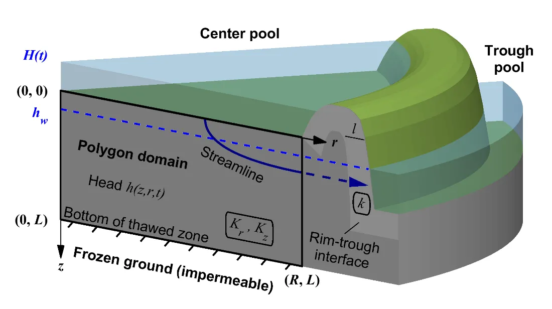
A schematic diagram of our three-dimensional axisymmetric analytical model of inundated low-centered polygon drainage.
For more information, please contact:
Dylan Harp
dharp@lanl.gov